Update 2-2-2025: www.northerncoloradotrail.org is now live.
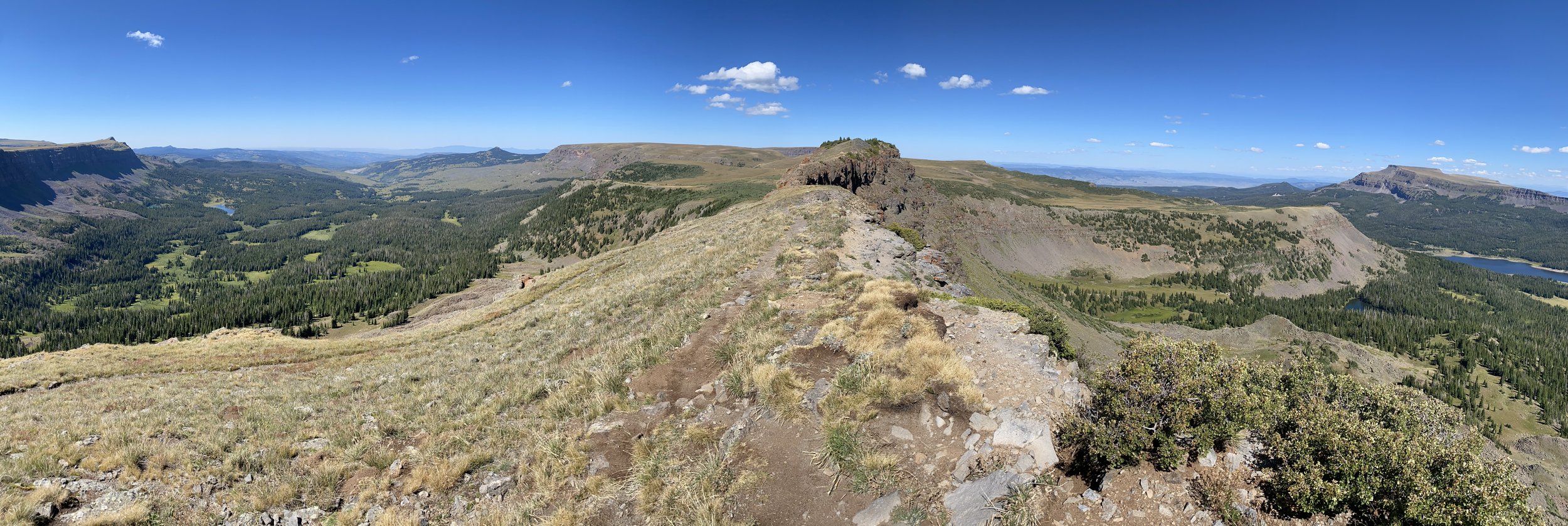
Devil’s Causeway - NCT Segment 4
Northern Colorado Trail (NCT)
Estes Park to Glenwood Springs
292.0 Miles - 470.0 Km
47,892ft - Ascent - 14,597m
48,671ft - Descent - 14,835m
12,537ft - High Point - 3821m
Northern Colorado Trail: Maps - Data Sheets - GPS Files
Southbound (SOBO)
The NCT is a long-distance trail, currently formed by linking multiple Northern Colorado hiking trails and roads into one seamless path from near Estes Park to Glenwood Springs.
If you would like to read a bit about the trail and how I came to pick this route, I wrote about it in my NCT 2024 blog.
This page is set up to distribute Northern Colorado Trail maps, data sheets, and GPS files so that anyone can use them to access the trail.
Please report any errors on the Northern Colorado Trail Facebook Page, as that will help the community get the information quickly.
Future plans include a dedicated website, water report, trail guidebook and more.
Many have asked how they can support the Northern Colorado Trail. Sharing this and the FB page goes a long way. Donations are greatly appreciated!
Thanks for checking it out.
-Sunshine
Trail Maps
Updated 1-30-2025
Click on map set links to download PDF versions of the Trail Maps
Map Sets with Multiple Maps will download in .rar format and will need to be decompressed

Northern Colorado Trail Segment 1 Overview Map
Segment 1: Dunraven TH to Walden
Redline
Alternate Routes

Northern Colorado Trail Segment 2 Overview Map
Segment 2: Walden to Hwy 40 (Steamboat Springs)
Redline
Steamboat Springs Town Maps (2)
Alternate Routes
Lone Pine Alternate (Orange) (1)
Lost Ranger Alternate (Purple) (2)
Rainbow Lake Alternate (Pink) (4)
Newcomb Creek Alternate (Teal) (5)
Percy Lake Low Route (Blue) (8)
Steamboat Springs Via Fish Creek Trail (No-hitch resupply) (4)

Northern Colorado Trail Segment 3 Overview Map

Northern Colorado Trail Segment 4 Overview Map
Segment 4: Yampa to Glenwood Springs
Redline
Detailed View - Map Set Pt. 1 (14)
Detailed View - Map Set Pt. 2 (14)
Glenwood Springs Town Maps (1)
Alternate Routes
Data Sheets
Updated 1-30-2025
Click on route to download PDF versions of the Data Sheets
Colors reference route color on the downloadable Maps
Segment 1: Dunraven TH to Walden
Comanche Peaks Bypass (Low Route) (Green) (6.5 miles - 10.5 km)
Medicine Bow Bypass (Low Route) (Blue) (9.1 miles - 14.6 km)
Segment 2: Walden to Hwy 40 (Steamboat Springs)
Segment 3: Hwy 40 to Yampa
Segment 4: Yampa to Glenwood Springs
GPS Files
Updated 1-30-2025
Click on file type to download GPS Files
Import GPS File to your favorite Trail Map Software/App
Segment 1: Dunraven TH to Walden
Dunraven TH to Walden - Redline: GPX || KML || GeoJSON
Comanche Peaks Bypass Green (Low Route): GPX || KML || GeoJSON
Medicine Bow Bypass Blue (Low Route): GPX || KML || GeoJSON
Segment 2: Walden to Hwy 40 (Steamboat Springs)
Walden to Hwy 40 Redline: GPX || KML || GeoJSON
Lone Pine Alternate Orange: GPX || KML || GeoJSON
Lone Ranger Alternate Purple: GPX || KML || GeoJSON
Rainbow Lake Alternate Pink: GPX || KML || GeoJSON
Newcomb Creek Alternate Teal: GPX || KML || GeoJSON
Percy Lake Alternate Blue (Low Route): GPX || KML || GeoJSON
Steamboat Springs Via Fish Creek Trail (No-hitch resupply): GPX || KML || GeoJSON
Segment 3: Hwy 40 to Yampa
Hwy 40 to Yampa - Redline: GPX || KML || GeoJSON
Hwy 40 to Oak Creek Blue (Alternate): GPX || KML || GeoJSON
Segment 4: Yampa to Glenwood Springs
Yampa to Glenwood Springs - Redline: GPX || KML || GeoJSON
Oak Creek to Glenwood Springs Blue (Alternate): GPX || KML || GeoJSON